|
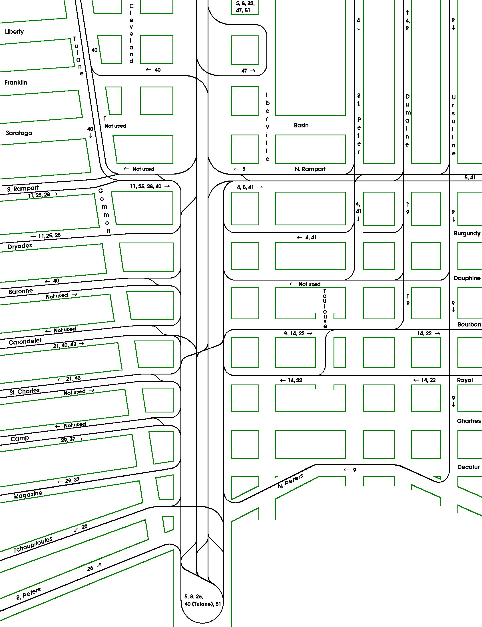
This is a highly schematic map of the trackage on Canal Street and in the Canal Street area in early 1930. Data are from the Beeler Report and NOPSI maps and History Book (see Acknowledgements and References at the end of Part V of this article). Only streets of interest are shown. The map is not drawn to any scale. The notation Not used means that no regular revenue service was offered on that track, but in most cases, the track was available for emergency and detour service. |